Follow the mountains south for new adventures
Capetonians love Table Mountain. They love hiking it and they love photographing it. Social media loves Table Mountain. Together with print media, this has led to Table Mountain being on everyone’s bucket list. The mountain is busier than ever, and trails are getting crowded. This has led to trail erosion, long waits at scrambles and increased conflict between trail users. And in some cases, serious accidents.
As impressive and beautiful as Table Mountain is, there are plenty of other trails for locals and tourists alike to explore. They are just as scenic, impressive and adventurous with far fewer people on them.
THE CENTRAL PENINSULA
Beyond the southern amphitheatre of Table Mountain, lie a few bumps between Constantia and Ou Kaapse Weg. Closest to Table Mountain is Vlakkenberg. The path starts just past La Parada restaurant (heading towards Hout Bay) at the circle at Constantia Nek. A sign to the left next to a gate points the way. It is not a particularly difficult trail, however it is in full sun, so start early and take plenty of water.
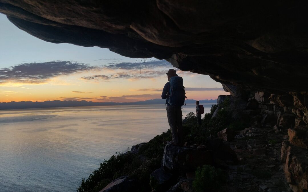
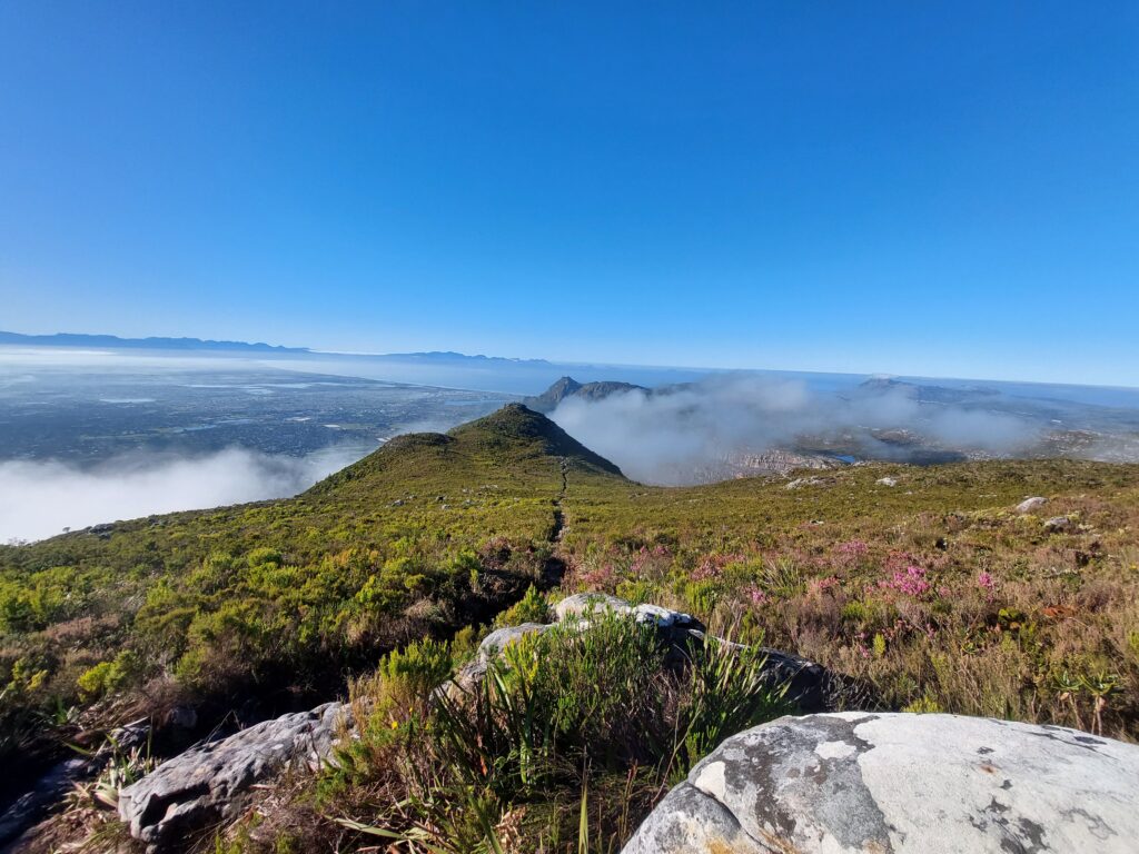
Constantiaberg, easily identifiable with the mast on top, can be accessed either by this same path, or from Silvermine. A fantastic option is to start at the dam in Silvermine, head up to Elephant’s Eye cave, then continue up to the summit of Constantiaberg. Spectacular views of the peninsula are your reward. Continue down into the amphitheatre above the dam to make a loop. This is also the path to give you access to Noordhoek Peak and the Panorama route in Silvermine Nature Reserve. For an easier walk with views to False Bay and the Cape Flats, try Steenberg ridge. Start at the first gravel parking lot once inside Silvermine. You may also encounter some rock climbers heading down to the crags below.
Climbing up Constantiaberg from Silvermine
AROUND HOUT BAY
The “Republic of Hout Bay” is geographically separated from the city by mountains, all offering their own unique adventures. The most popular hike above Hout Bay is Chapman’s Peak. Starting from the Drive of the same name, park at the “turn around” point (you don’t have to pay the toll). From here, it’s a relatively straightforward hike (about 1.5 hours) with easy to follow paths. The last 20-30 minutes are quite steep. There are views into Hout Bay, over Noordhoek beach and False Bay; most likely you can enjoy these alone.
Looking into Hout Bay from Chapman’s Peak

If you don’t want to climb too high, park at East Fort on Chapman’s Peak drive and walk around the trails on the lower slopes. East Fort is part of the military history of the Cape and those fighting over it. Head up to the contour path to find a lovely patch of lush vegetation and cascades. If you continue up past these falls, you’re into the steep switchbacks that take you to the top of Blackburn Ravine.
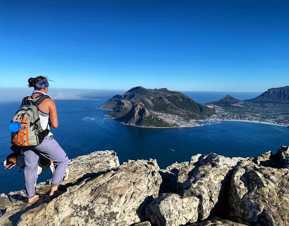
On the other side of Hout Bay are three enticing peaks. The smallest is Klein Leeuwkoppie (Little Lion’s Head) or as it is more formally known, Mount Rhodes. Considered a satellite peak of Table Mountain this little peak offers sunset views to rival its popular big brother. It only takes a half hour or so to climb with one minor scramble towards the top – and you can have a mountain all to yourself!
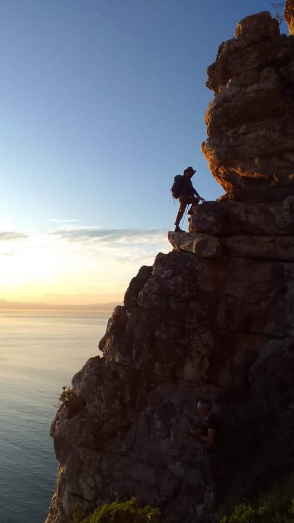
Heading south you’ll encounter Suther Peak and guarding the bay itself, the Sentinel. In between these two peaks is Karbonkelberg. It’s here you’ll find the old radar station, Fort Collins. To ensure your safety, hire local, qualified guides from Hout Bay who can guide you on these trails. They know these mountains like the back of their hands and can take you to all the hidden gems! The Sentinel also has a C-grade scramble option, so if you are experienced, hire a guide to take you to some dizzying views. *
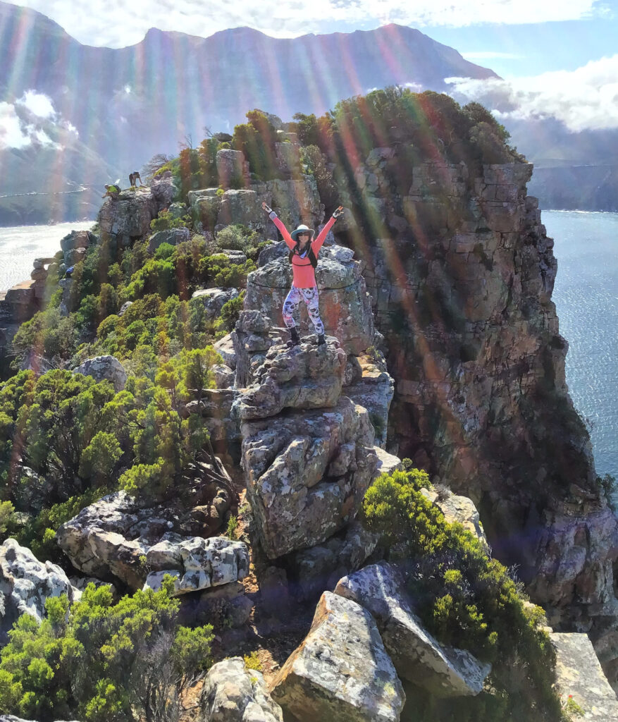
Scrambling up the Sentinel
THE DEEP SOUTH
If you are willing to venture beyond the lentil curtain, you’ll find some magical spots to explore. The first peak overlooking Muizenberg is, surprisingly, Muizenberg Peak! An easy to follow path on a steady incline ends with open views over False Bay and the Cape Flats. Just next to Muizenberg Peak is St James Peak. These two combined make for a great loop; there are also pools and streams you can visit.
Continuing south is Elsie’s Peak above Fishhoek. There are a few options for trails here. There are easier trails heading up either from the Glencairn or Fishhoek side of the peak. These are dog friendly, however, there are resident klipspringer here. It would be greatly appreciated if dogs were kept on lead in this area. For the adventurous who don’t mind heights and exposure, there is a C-grade scramble up to the summit. You do need to hire a guide for this though, as harnesses and ropes may be required in several places, not to mention some tricky route finding. **
Climbing up the C-grade scramble route on Elsie’s Peak (Eva Kjellsdotter)
At the end of the long road is the most southwestern tip of Africa, the Cape of Good Hope reserve. There is the popular two day hike, but also several day hikes. With two vehicles and one day you can do either side of the overnight hike. The False Bay side has more elevation and is 13km. The western side is 21km but mostly flat. For either side there are several parking areas along the way to shorten the hike.
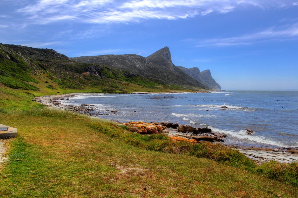
Views in Cape Point on the False Bay side
On the False Bay side is a circular loop to Kanonkop from Booi se skêrm. Combine this with some beach exploring or a visit to the colourful Venus pools (at low tide). On the west coast there is the Shipwreck trail or the Sirkelsvlei loop around the only freshwater pool in the reserve. Keep your eyes open for eland, ostrich, bontebok, klipspringer, zebra, baboons, birds – and puff adders!
GO BEYOND
As wonderful and exciting as Table Mountain is, there are other areas of the Peninsula that are equally so. Silvermine and Cape Point are rich in their unique vegetation, birdlife, and animals, with many endemic species. Beyond Table Mountain are fewer crowds, less traffic, and more open spaces. There’s no waiting in line on trails, no fighting for space to take your photos.
So, get the maps and guidebooks for the peninsula, be prepared to drive a little further, and enjoy the peace of nature. ***
* Hilltop Adventures (on Facebook and Instagram)
** Guided by Mike (also on Facebook)
*** Always research new routes thoroughly or hire a guide. Don’t only rely on mobile apps. Be properly prepared for the day out with sufficient water, snacks and clothing. Save WSAR number in your phone – 021 937 0300.